
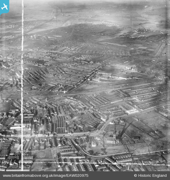
EAW020975 ENGLAND (1949). The Rylands Brothers Ltd Wire Works and environs, Warrington, from the south-east, 1949. This image was marked by Aerofilms Ltd for photo editing.
© Copyright OpenStreetMap contributors and licensed by the OpenStreetMap Foundation. 2026. Cartography is licensed as CC BY-SA.
Nearby Images (14)
EAW020975

EAW020969

EAW020968

EAW020967

EAW020971

EAW020970

EAW020974

EAW020972

EAW020977

EAW020973

EAW020976

EPW005009

EAW020961

EPW005006

Details
| Title | [EAW020975] The Rylands Brothers Ltd Wire Works and environs, Warrington, from the south-east, 1949. This image was marked by Aerofilms Ltd for photo editing. |
| Reference | EAW020975 |
| Date | 10-February-1949 |
| Link | |
| Place name | WARRINGTON |
| Parish | |
| District | |
| Country | ENGLAND |
| Easting / Northing | 361393, 388481 |
| Longitude / Latitude | -2.5805998619534, 53.391489818449 |
| National Grid Reference | SJ614885 |
