
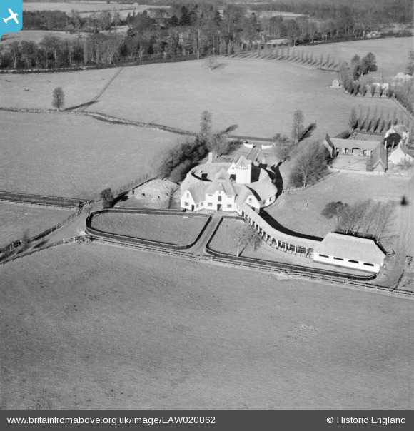
EAW020862 ENGLAND (1949). The bfa_img Court, Driver's End, 1949
© Copyright OpenStreetMap contributors and licensed by the OpenStreetMap Foundation. 2025. Cartography is licensed as CC BY-SA.
Nearby Images (2)
EAW020862

EAW020861

Details
| Title | [EAW020862] The bfa_img Court, Driver's End, 1949 |
| Reference | EAW020862 |
| Date | 2-February-1949 |
| Link | |
| Place name | DRIVER'S END |
| Parish | CODICOTE |
| District | |
| Country | ENGLAND |
| Easting / Northing | 522006, 219768 |
| Longitude / Latitude | -0.22797487807474, 51.862695619344 |
| National Grid Reference | TL220198 |
Pins
Be the first to add a comment to this image!
User Comment Contributions
Model dairy built in 1928. Now used as offices |

MB |
Monday 6th of January 2014 08:20:51 PM |