
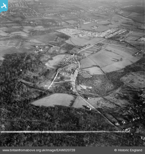
EAW020728 ENGLAND (1948). New housing development at St Paul's Wood Hill, St Paul's Cray, 1948. This image was marked by Aerofilms Ltd for photo editing.
© Copyright OpenStreetMap contributors and licensed by the OpenStreetMap Foundation. 2026. Cartography is licensed as CC BY-SA.
Nearby Images (4)
EAW020728

EAW026818

EPW045552

EAW026819

Details
| Title | [EAW020728] New housing development at St Paul's Wood Hill, St Paul's Cray, 1948. This image was marked by Aerofilms Ltd for photo editing. |
| Reference | EAW020728 |
| Date | 24-December-1948 |
| Link | |
| Place name | ST PAUL'S CRAY |
| Parish | |
| District | |
| Country | ENGLAND |
| Easting / Northing | 545682, 169535 |
| Longitude / Latitude | 0.094759506706705, 51.405610679755 |
| National Grid Reference | TQ457695 |
Pins

Broom1 |
Tuesday 16th of February 2016 09:09:01 PM | |
|
Broom1 |
Tuesday 16th of February 2016 09:06:46 PM | |
|
Broom1 |
Tuesday 16th of February 2016 09:04:14 PM | |
|
Broom1 |
Tuesday 16th of February 2016 09:03:02 PM | |
|
Gone2Kent |
Sunday 9th of February 2014 05:05:30 PM |
