
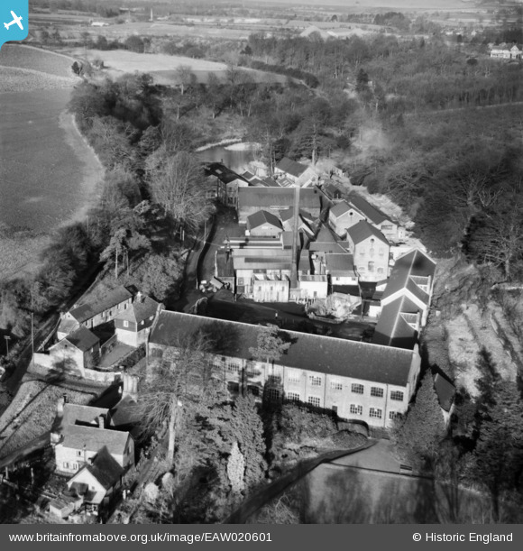
EAW020601 ENGLAND (1948). Basted Paper Mills, Basted, 1948
© Copyright OpenStreetMap contributors and licensed by the OpenStreetMap Foundation. 2026. Cartography is licensed as CC BY-SA.
Nearby Images (21)
EAW020601

EAW020602

EAW014303

EAW020609

EAW014302

EAW020603

EAW020606

EAW014298

EAW014297

EAW014299

EAW014301

EAW014300

EAW020612

EAW020604

EAW020607

EAW014296

EAW020605

EAW020608

EAW020613

EAW020610

EAW020611

Details
| Title | [EAW020601] Basted Paper Mills, Basted, 1948 |
| Reference | EAW020601 |
| Date | 8-December-1948 |
| Link | |
| Place name | BASTED |
| Parish | PLATT |
| District | |
| Country | ENGLAND |
| Easting / Northing | 560734, 155931 |
| Longitude / Latitude | 0.30486953109419, 51.279306239956 |
| National Grid Reference | TQ607559 |
Pins
Be the first to add a comment to this image!
User Comment Contributions

Established 1750. Owned by Basted Paper Mills Co, Wiggins Teape and Co. (1919) Ltd. 1923 Two machines. Manufactured Superfine Writings. Bank, Loan, Drawing and Ledger Papers, Typewritings, Chart and Map Papers, Lithographic Papers, Bank Note Papers. Special Watermarks. Closed 1949 https://bgphotos.wordpress.com/theme/basted-2/mill-history/ |

Chris |
Saturday 30th of July 2016 11:30:48 AM |
Established 1750. Owned by Basted Paper Mills Co, Wiggins Teape and Co. (1919) Ltd. 1923 Two machines. Manufactured Superfine Writings. Bank, Loan, Drawing and Ledger Papers, Typewritings, Chart and Map Papers, Lithographic Papers, Bank Note Papers. Special Watermarks. Closed 1949 |
Chris |
Saturday 30th of July 2016 11:30:09 AM |