
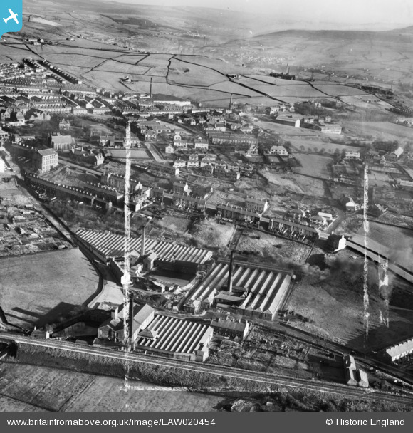
EAW020454 ENGLAND (1948). Spring Vale, Waterside and Charles Lane Cotton Mills and environs, Haslingden, 1948. This image was marked by Aerofilms Ltd for photo editing.
© Copyright OpenStreetMap contributors and licensed by the OpenStreetMap Foundation. 2026. Cartography is licensed as CC BY-SA.
Nearby Images (6)
EAW020454

EAW020456

EAW020455

EAW020457

EAW020453

EAW020451

Details
| Title | [EAW020454] Spring Vale, Waterside and Charles Lane Cotton Mills and environs, Haslingden, 1948. This image was marked by Aerofilms Ltd for photo editing. |
| Reference | EAW020454 |
| Date | 8-November-1948 |
| Link | |
| Place name | HASLINGDEN |
| Parish | |
| District | |
| Country | ENGLAND |
| Easting / Northing | 378388, 422822 |
| Longitude / Latitude | -2.3273967759991, 53.701158718756 |
| National Grid Reference | SD784228 |
Pins

wadey |
Saturday 22nd of December 2018 02:14:19 PM | |
|
wadey |
Saturday 22nd of December 2018 02:13:03 PM | |
|
wadey |
Saturday 22nd of December 2018 02:12:02 PM | |
|
wadey |
Saturday 22nd of December 2018 02:11:08 PM | |
|
wadey |
Saturday 22nd of December 2018 02:09:57 PM |