
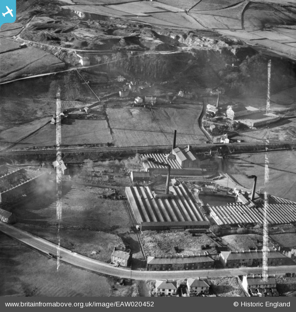
EAW020452 ENGLAND (1948). Spring Vale, Waterside and Charles Lane Cotton Mills, Haslingden, 1948. This image was marked by Aerofilms Ltd for photo editing.
© Copyright OpenStreetMap contributors and licensed by the OpenStreetMap Foundation. 2026. Cartography is licensed as CC BY-SA.
Nearby Images (5)
EAW020452

EAW020453

EAW020451

EAW020456

EAW020455

Details
| Title | [EAW020452] Spring Vale, Waterside and Charles Lane Cotton Mills, Haslingden, 1948. This image was marked by Aerofilms Ltd for photo editing. |
| Reference | EAW020452 |
| Date | 8-November-1948 |
| Link | |
| Place name | HASLINGDEN |
| Parish | |
| District | |
| Country | ENGLAND |
| Easting / Northing | 378124, 422864 |
| Longitude / Latitude | -2.3313989630712, 53.70152526147 |
| National Grid Reference | SD781229 |
Pins

wadey |
Sunday 23rd of December 2018 12:33:23 AM | |
|
wadey |
Saturday 22nd of December 2018 04:15:09 PM | |
|
wadey |
Saturday 22nd of December 2018 04:14:20 PM |