
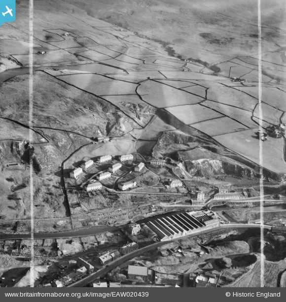
EAW020439 ENGLAND (1948). Sladen Wood Cotton Mill and environs, Calderbrook, from the north-west, 1948. This image was marked by Aerofilms Ltd for photo editing.
© Copyright OpenStreetMap contributors and licensed by the OpenStreetMap Foundation. 2025. Cartography is licensed as CC BY-SA.
Nearby Images (8)
EAW020439

EAW020437

EAW020441

EAW020438

EAW020440

EAW020436

EAW020442

EAW020443

Details
| Title | [EAW020439] Sladen Wood Cotton Mill and environs, Calderbrook, from the north-west, 1948. This image was marked by Aerofilms Ltd for photo editing. |
| Reference | EAW020439 |
| Date | 8-November-1948 |
| Link | |
| Place name | CALDERBROOK |
| Parish | |
| District | |
| Country | ENGLAND |
| Easting / Northing | 394702, 418296 |
| Longitude / Latitude | -2.0801819317378, 53.660894150831 |
| National Grid Reference | SD947183 |
Pins

batfink123 |
Friday 20th of June 2014 09:44:22 PM | |
|
batfink123 |
Friday 20th of June 2014 09:43:57 PM | |
|
batfink123 |
Friday 20th of June 2014 09:43:22 PM |