
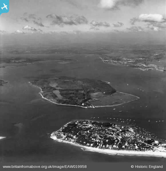
EAW019958 ENGLAND (1948). Sandbanks, Brownsea Island and Poole Harbour, Sandbanks, from the south-east, 1948. This image has been produced from a print.
© Copyright OpenStreetMap contributors and licensed by the OpenStreetMap Foundation. 2026. Cartography is licensed as CC BY-SA.
Nearby Images (3)
EAW019958

EAW010970

EAW010962

Details
| Title | [EAW019958] Sandbanks, Brownsea Island and Poole Harbour, Sandbanks, from the south-east, 1948. This image has been produced from a print. |
| Reference | EAW019958 |
| Date | 19-October-1948 |
| Link | |
| Place name | SANDBANKS |
| Parish | |
| District | |
| Country | ENGLAND |
| Easting / Northing | 403525, 87448 |
| Longitude / Latitude | -1.9500957275695, 50.686097120923 |
| National Grid Reference | SZ035874 |
