
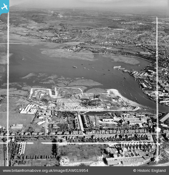
EAW019954 ENGLAND (1948). Holes Bay and construction of the Hamworthy Power Station, Lower Hamworthy, from the south-west, 1948. This image was marked by Aerofilms Ltd for photo editing.
© Copyright OpenStreetMap contributors and licensed by the OpenStreetMap Foundation. 2026. Cartography is licensed as CC BY-SA.
Nearby Images (22)
EAW019954

EAW019949

EAW019946

EAW004200

EAW019944

EAW019951

EAW004195

EAW004196

EAW004197

EAW004205

EAW004199

EAW019947

EAW019948

EAW019950

EAW004201

EAW004194

EAW019953

EAW004198

EAW004206

EAW004208

EAW004209

EAW004207

Details
| Title | [EAW019954] Holes Bay and construction of the Hamworthy Power Station, Lower Hamworthy, from the south-west, 1948. This image was marked by Aerofilms Ltd for photo editing. |
| Reference | EAW019954 |
| Date | 19-October-1948 |
| Link | |
| Place name | LOWER HAMWORTHY |
| Parish | |
| District | |
| Country | ENGLAND |
| Easting / Northing | 400218, 90445 |
| Longitude / Latitude | -1.9969119513675, 50.713062002795 |
| National Grid Reference | SZ002904 |
Pins

ken |
Saturday 13th of June 2015 02:03:18 PM |