
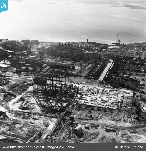
EAW019949 ENGLAND (1948). Construction of the Hamworthy Power Station, Lower Hamworthy, 1948. This image has been produced from a print.
© Copyright OpenStreetMap contributors and licensed by the OpenStreetMap Foundation. 2026. Cartography is licensed as CC BY-SA.
Nearby Images (24)
EAW019949

EAW019951

EAW019954

EAW019944

EAW019946

EAW004195

EAW004200

EAW004199

EAW004197

EAW004196

EAW004194

EAW019947

EAW019950

EAW004201

EAW004205

EAW019948

EAW019953

EAW004206

EAW004198

EAW004209

EAW004208

EPW013631

EAW004207

EAW019952

Details
| Title | [EAW019949] Construction of the Hamworthy Power Station, Lower Hamworthy, 1948. This image has been produced from a print. |
| Reference | EAW019949 |
| Date | 19-October-1948 |
| Link | |
| Place name | LOWER HAMWORTHY |
| Parish | |
| District | |
| Country | ENGLAND |
| Easting / Northing | 400284, 90456 |
| Longitude / Latitude | -1.9959770290956, 50.713160905203 |
| National Grid Reference | SZ003905 |
Pins

incony |
Thursday 7th of May 2020 12:59:01 AM |