
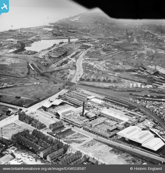
EAW018587 ENGLAND (1948). The Hollis Brothers and Co Ltd Saw Mill, Kingston Upon Hull, 1948
© Copyright OpenStreetMap contributors and licensed by the OpenStreetMap Foundation. 2026. Cartography is licensed as CC BY-SA.
Nearby Images (29)
EAW018587

EPW055035

EPW042061

EPW055044

EAW018585

EAW018590

EPW042062

EAW018591

EPW062607

EPW042064

EPW042065

EPW013930

EPW013929

EPW042063

EPW013928

EAW018586

EPW042795

EPW013931

EPW042799

EPW013932

EAW015660

EPW042801

EAW018592

EPW062606

EPW062609

EPW013933

EPW042796

EPW062610

EPW042798

Details
| Title | [EAW018587] The Hollis Brothers and Co Ltd Saw Mill, Kingston Upon Hull, 1948 |
| Reference | EAW018587 |
| Date | 10-September-1948 |
| Link | |
| Place name | KINGSTON UPON HULL |
| Parish | |
| District | |
| Country | ENGLAND |
| Easting / Northing | 511350, 429208 |
| Longitude / Latitude | -0.31126571564536, 53.747113854696 |
| National Grid Reference | TA114292 |
Pins

Sharmo |
Sunday 22nd of February 2015 09:55:53 AM | |
|
Sharmo |
Sunday 22nd of February 2015 09:53:10 AM | |
|
Sharmo |
Sunday 22nd of February 2015 09:50:46 AM | |
|
Sharmo |
Sunday 22nd of February 2015 09:48:43 AM | |
|
Sharmo |
Sunday 22nd of February 2015 09:45:48 AM | |
|
John Wass |
Tuesday 19th of August 2014 09:17:01 PM |


