
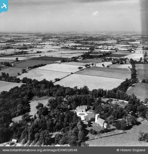
EAW018548 ENGLAND (1948). Belchamp Hall, St Mary's Church and the surrounding countryside, Belchamp Walter, from the east, 1948. This image has been produced from a print.
© Copyright OpenStreetMap contributors and licensed by the OpenStreetMap Foundation. 2025. Cartography is licensed as CC BY-SA.
Nearby Images (5)
EAW018548

EAW018547

EAW018549

EAW018546

EAW018550

Details
| Title | [EAW018548] Belchamp Hall, St Mary's Church and the surrounding countryside, Belchamp Walter, from the east, 1948. This image has been produced from a print. |
| Reference | EAW018548 |
| Date | 9-September-1948 |
| Link | |
| Place name | BELCHAMP WALTER |
| Parish | BELCHAMP WALTER |
| District | |
| Country | ENGLAND |
| Easting / Northing | 582647, 240678 |
| Longitude / Latitude | 0.66303604346256, 52.033960497493 |
| National Grid Reference | TL826407 |
Pins
Be the first to add a comment to this image!