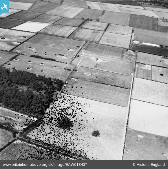
EAW018437 ENGLAND (1948). The N. W. Hempsall Ltd poultry-rearing farm, Walesby, 1948. This image has been produced from a damaged negative.
© Copyright OpenStreetMap contributors and licensed by the OpenStreetMap Foundation. 2026. Cartography is licensed as CC BY-SA.
Nearby Images (7)
Details
| Title | [EAW018437] The N. W. Hempsall Ltd poultry-rearing farm, Walesby, 1948. This image has been produced from a damaged negative. |
| Reference | EAW018437 |
| Date | 30-August-1948 |
| Link | |
| Place name | WALESBY |
| Parish | WALESBY |
| District | |
| Country | ENGLAND |
| Easting / Northing | 467480, 370855 |
| Longitude / Latitude | -0.988996020752, 53.230160680752 |
| National Grid Reference | SK675709 |
Pins
Be the first to add a comment to this image!


![[EAW018437] The N. W. Hempsall Ltd poultry-rearing farm, Walesby, 1948. This image has been produced from a damaged negative.](http://britainfromabove.org.uk/sites/all/libraries/aerofilms-images/public/100x100/EAW/018/EAW018437.jpg)
![[EAW018435] The N. W. Hempsall Ltd poultry-rearing farm and the surrounding countryside, Walesby, 1948](http://britainfromabove.org.uk/sites/all/libraries/aerofilms-images/public/100x100/EAW/018/EAW018435.jpg)
![[EAW018433] The N. W. Hempsall Ltd poultry-rearing farm and the surrounding countryside, Walesby, 1948. This image was marked by Aerofilms Ltd for photo editing.](http://britainfromabove.org.uk/sites/all/libraries/aerofilms-images/public/100x100/EAW/018/EAW018433.jpg)
![[EAW018434] The N. W. Hempsall Ltd poultry-rearing farm and the surrounding countryside, Walesby, 1948. This image was marked by Aerofilms Ltd for photo editing.](http://britainfromabove.org.uk/sites/all/libraries/aerofilms-images/public/100x100/EAW/018/EAW018434.jpg)
![[EAW018432] The N. W. Hempsall Ltd poultry-rearing farm and the surrounding countryside, Walesby, 1948. This image was marked by Aerofilms Ltd for photo editing.](http://britainfromabove.org.uk/sites/all/libraries/aerofilms-images/public/100x100/EAW/018/EAW018432.jpg)
![[EAW018438] The N. W. Hempsall Ltd poultry-rearing farm (site of) and the surrounding area, Walesby, 1948. This image has been produced from a damaged negative.](http://britainfromabove.org.uk/sites/all/libraries/aerofilms-images/public/100x100/EAW/018/EAW018438.jpg)
![[EAW018439] The N. W. Hempsall Ltd poultry-rearing farm and the surrounding area, Walesby, 1948. This image has been produced from a print.](http://britainfromabove.org.uk/sites/all/libraries/aerofilms-images/public/100x100/EAW/018/EAW018439.jpg)