
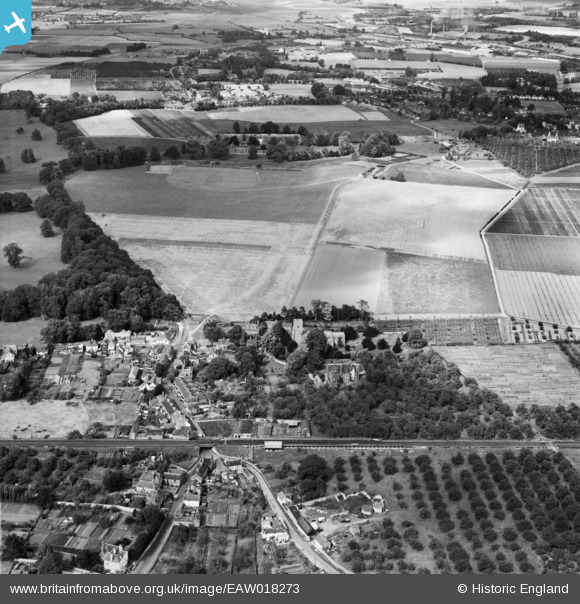
EAW018273 ENGLAND (1948). The East Malling Research Station (Horticultural) site and the village, East Malling, 1948
© Copyright OpenStreetMap contributors and licensed by the OpenStreetMap Foundation. 2026. Cartography is licensed as CC BY-SA.
Nearby Images (5)
EAW018273
 site and the village, East Malling, 1948")
EAW018274
 site, East Malling, 1948")
EAW018271
 site and St James's Church, East Malling, 1948")
EAW019461
 site and environs, East Malling, 1948. This image has been produced from a print.")
EAW018272
 site and St James's Church, East Malling, 1948")
Details
| Title | [EAW018273] The East Malling Research Station (Horticultural) site and the village, East Malling, 1948 |
| Reference | EAW018273 |
| Date | 20-August-1948 |
| Link | |
| Place name | EAST MALLING |
| Parish | EAST MALLING AND LARKFIELD |
| District | |
| Country | ENGLAND |
| Easting / Northing | 570298, 157223 |
| Longitude / Latitude | 0.4425000239627, 51.288135627313 |
| National Grid Reference | TQ703572 |
Pins
Be the first to add a comment to this image!