
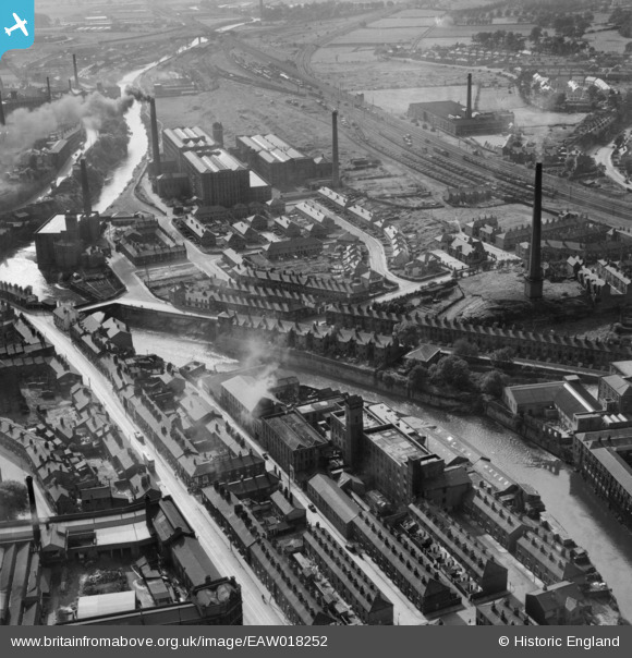
EAW018252 ENGLAND (1948). Cotton mills and houses along the River Mersey, Stockport, 1948. This image was marked by Aerofilms Ltd for photo editing.
© Copyright OpenStreetMap contributors and licensed by the OpenStreetMap Foundation. 2026. Cartography is licensed as CC BY-SA.
Nearby Images (8)
EAW018252

EAW018253

EAW018251

EAW018250

EAW018255

EPW036823

EAW018254

EAW018256

Details
| Title | [EAW018252] Cotton mills and houses along the River Mersey, Stockport, 1948. This image was marked by Aerofilms Ltd for photo editing. |
| Reference | EAW018252 |
| Date | 18-August-1948 |
| Link | |
| Place name | STOCKPORT |
| Parish | |
| District | |
| Country | ENGLAND |
| Easting / Northing | 388519, 390149 |
| Longitude / Latitude | -2.1727246867694, 53.407771170626 |
| National Grid Reference | SJ885901 |
Pins

parrot |
Monday 14th of June 2021 06:20:50 PM | |
|
parrot |
Monday 14th of June 2021 06:18:45 PM | |
|
parrot |
Monday 14th of June 2021 06:17:23 PM | |
|
parrot |
Monday 14th of June 2021 06:17:02 PM | |
|
parrot |
Monday 14th of June 2021 06:16:31 PM | |
|
parrot |
Monday 14th of June 2021 06:15:49 PM | |
|
parrot |
Monday 14th of June 2021 06:14:25 PM |