
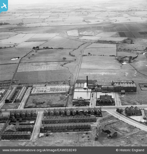
EAW018249 ENGLAND (1948). Mills and houses along Chorley New Road, Horwich, from the north-east, 1948
© Copyright OpenStreetMap contributors and licensed by the OpenStreetMap Foundation. 2026. Cartography is licensed as CC BY-SA.
Nearby Images (9)
EAW018249

EAW018248

EAW018246

EAW018247

EAW018244

EAW018242

EAW018241

EAW018245

EAW018243

Details
| Title | [EAW018249] Mills and houses along Chorley New Road, Horwich, from the north-east, 1948 |
| Reference | EAW018249 |
| Date | 18-August-1948 |
| Link | |
| Place name | HORWICH |
| Parish | HORWICH |
| District | |
| Country | ENGLAND |
| Easting / Northing | 364648, 410449 |
| Longitude / Latitude | -2.5341266260915, 53.589190064542 |
| National Grid Reference | SD646104 |
Pins
Be the first to add a comment to this image!