
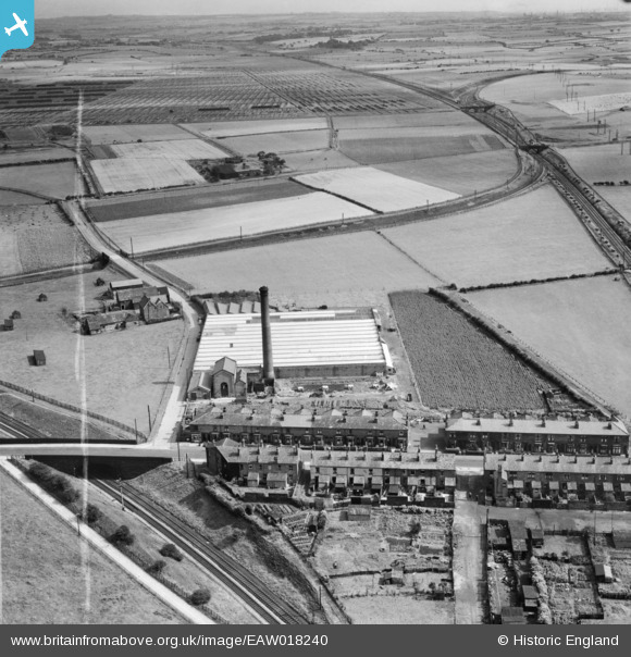
EAW018240 ENGLAND (1948). Blackrod Mill and houses on Station Road, Blackrod, from the north-west, 1948. This image was marked by Aerofilms Ltd for photo editing.
© Copyright OpenStreetMap contributors and licensed by the OpenStreetMap Foundation. 2026. Cartography is licensed as CC BY-SA.
Nearby Images (8)
EAW018240

EAW018235

EAW018234

EAW018236

EAW018233

EAW018237

EAW018239

EAW018238

Details
| Title | [EAW018240] Blackrod Mill and houses on Station Road, Blackrod, from the north-west, 1948. This image was marked by Aerofilms Ltd for photo editing. |
| Reference | EAW018240 |
| Date | 18-August-1948 |
| Link | |
| Place name | BLACKROD |
| Parish | BLACKROD |
| District | |
| Country | ENGLAND |
| Easting / Northing | 362576, 410644 |
| Longitude / Latitude | -2.5654538497466, 53.590799066464 |
| National Grid Reference | SD626106 |
Pins

FrankH |
Wednesday 28th of October 2020 10:19:47 PM | |
|
FrankH |
Wednesday 28th of October 2020 10:18:19 PM | |
|
FrankH |
Wednesday 28th of October 2020 10:17:16 PM |
User Comment Contributions
horwich fork juntion |
michael snape |
Thursday 17th of July 2014 10:13:31 PM |