
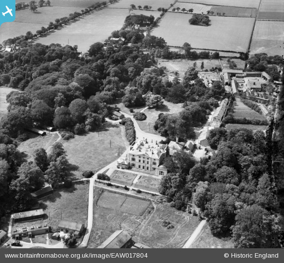
EAW017804 ENGLAND (1948). Highlegh Hall, High Legh, 1948
© Copyright OpenStreetMap contributors and licensed by the OpenStreetMap Foundation. 2026. Cartography is licensed as CC BY-SA.
Nearby Images (5)
EAW017804

EAW017802

EAW017801

EAW017803

EAW017805

Details
| Title | [EAW017804] Highlegh Hall, High Legh, 1948 |
| Reference | EAW017804 |
| Date | 28-July-1948 |
| Link | |
| Place name | HIGH LEGH |
| Parish | HIGH LEGH |
| District | |
| Country | ENGLAND |
| Easting / Northing | 370136, 383910 |
| Longitude / Latitude | -2.4486893952962, 53.350966301417 |
| National Grid Reference | SJ701839 |
Pins

clippedwings |
Monday 31st of August 2015 10:01:27 AM |
User Comment Contributions
I think this is also known as East Hall. Now demolished |

James Chandler |
Sunday 30th of August 2015 07:17:04 PM |