
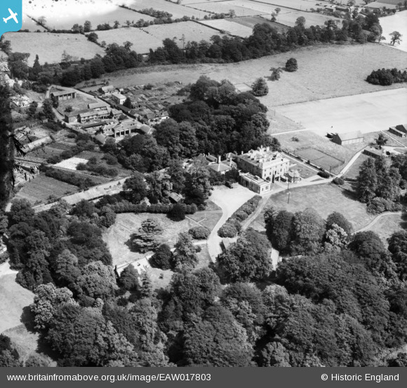
EAW017803 ENGLAND (1948). Highlegh Hall, High Legh, 1948
© Copyright OpenStreetMap contributors and licensed by the OpenStreetMap Foundation. 2026. Cartography is licensed as CC BY-SA.
Nearby Images (5)
EAW017803

EAW017801

EAW017805

EAW017804

EAW017802

Details
| Title | [EAW017803] Highlegh Hall, High Legh, 1948 |
| Reference | EAW017803 |
| Date | 28-July-1948 |
| Link | |
| Place name | HIGH LEGH |
| Parish | HIGH LEGH |
| District | |
| Country | ENGLAND |
| Easting / Northing | 370186, 383931 |
| Longitude / Latitude | -2.4479401783113, 53.351157900752 |
| National Grid Reference | SJ702839 |
Pins
Be the first to add a comment to this image!