
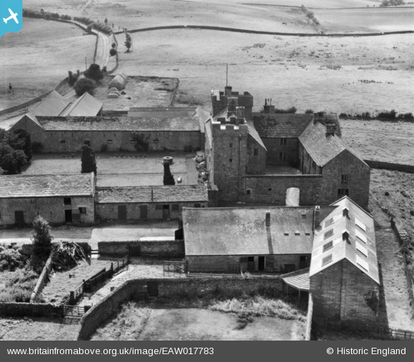
EAW017783 ENGLAND (1948). Askerton Castle, Kirkcambeck, 1948. This image has been produced from a print.
© Copyright OpenStreetMap contributors and licensed by the OpenStreetMap Foundation. 2026. Cartography is licensed as CC BY-SA.
Nearby Images (4)
EAW017783

EAW017780

EAW017781

EAW017782

Details
| Title | [EAW017783] Askerton Castle, Kirkcambeck, 1948. This image has been produced from a print. |
| Reference | EAW017783 |
| Date | 28-July-1948 |
| Link | |
| Place name | KIRKCAMBECK |
| Parish | ASKERTON |
| District | |
| Country | ENGLAND |
| Easting / Northing | 355040, 569263 |
| Longitude / Latitude | -2.7031961411183, 55.015811501348 |
| National Grid Reference | NY550693 |
Pins
Be the first to add a comment to this image!
User Comment Contributions
Askerton Castle was built in the village of Askerton in Cumbria around 1300. Originally the castle was an unfortified manor, but in the late-15th century William Dacre, the third Baron, built two crenellated towers on either end of the hall range, probably with the aim of increasing the living space in the property rather than simply for reasons of defence. A third tower may have been built on the north-west corner of the property, this time for defensive purposes, but has since been lost. The castle was renovated by architect Anthony Salvin in the 1850s. Askerton Castle is a Grade I listed building. |

Billy Turner |
Wednesday 18th of November 2015 07:24:12 PM |