
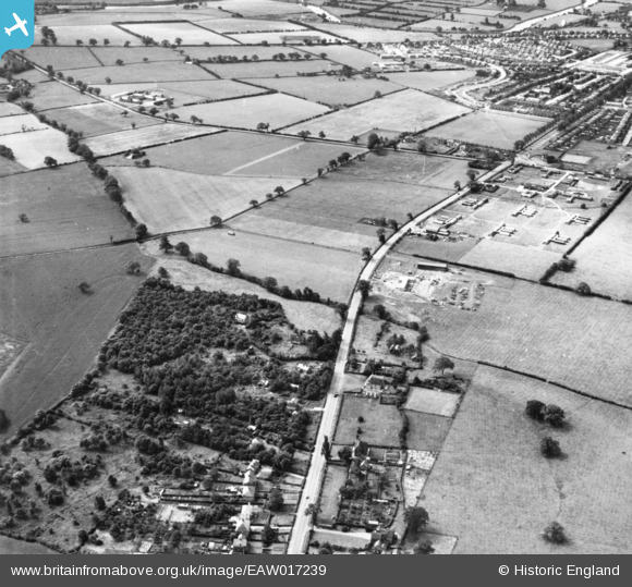
EAW017239 ENGLAND (1948). Whitchurch Road and environs, Harlescott, 1948. This image has been produced from a print.
© Copyright OpenStreetMap contributors and licensed by the OpenStreetMap Foundation. 2025. Cartography is licensed as CC BY-SA.
Nearby Images (4)
EAW017239

EAW006776

EAW006778

EAW006777

Details
| Title | [EAW017239] Whitchurch Road and environs, Harlescott, 1948. This image has been produced from a print. |
| Reference | EAW017239 |
| Date | 19-July-1948 |
| Link | |
| Place name | HARLESCOTT |
| Parish | SHREWSBURY |
| District | |
| Country | ENGLAND |
| Easting / Northing | 351502, 316110 |
| Longitude / Latitude | -2.7184282560328, 52.740102006719 |
| National Grid Reference | SJ515161 |
