
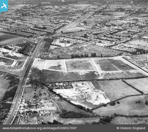
EAW017097 ENGLAND (1948). The site of the housing estate surrounding Arundel Road and Beavers Lane and environs, Hounslow West, 1948. This image has been produced from a print.
© Copyright OpenStreetMap contributors and licensed by the OpenStreetMap Foundation. 2025. Cartography is licensed as CC BY-SA.
Nearby Images (9)
EAW017097

EAW017102

EAW017103

EAW017100

EAW017099

EAW017101

EAW017096

EPW017159

EAW017098

Details
| Title | [EAW017097] The site of the housing estate surrounding Arundel Road and Beavers Lane and environs, Hounslow West, 1948. This image has been produced from a print. |
| Reference | EAW017097 |
| Date | 6-July-1948 |
| Link | |
| Place name | HOUNSLOW WEST |
| Parish | |
| District | |
| Country | ENGLAND |
| Easting / Northing | 511145, 175904 |
| Longitude / Latitude | -0.39960735477005, 51.470684636522 |
| National Grid Reference | TQ111759 |
Pins

Isleworth1961 |
Monday 24th of November 2014 09:30:35 PM | |
|
Isleworth1961 |
Monday 24th of November 2014 09:29:07 PM | |
|
Isleworth1961 |
Monday 24th of November 2014 09:28:22 PM | |
|
Isleworth1961 |
Monday 24th of November 2014 09:27:50 PM | |
|
Isleworth1961 |
Monday 24th of November 2014 09:27:03 PM | |
|
Isleworth1961 |
Monday 24th of November 2014 09:24:20 PM |