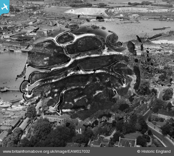
EAW017032 ENGLAND (1948). Rochester Castle (site of), town and the River Medway, Rochester, 1948. This image has been produced from a damaged negative.
© Copyright OpenStreetMap contributors and licensed by the OpenStreetMap Foundation. 2026. Cartography is licensed as CC BY-SA.
Nearby Images (26)
Details
| Title | [EAW017032] Rochester Castle (site of), town and the River Medway, Rochester, 1948. This image has been produced from a damaged negative. |
| Reference | EAW017032 |
| Date | 6-July-1948 |
| Link | |
| Place name | ROCHESTER |
| Parish | |
| District | |
| Country | ENGLAND |
| Easting / Northing | 574152, 168649 |
| Longitude / Latitude | 0.50330886427748, 51.389623379118 |
| National Grid Reference | TQ742686 |
Pins
Be the first to add a comment to this image!


![[EAW017032] Rochester Castle (site of), town and the River Medway, Rochester, 1948. This image has been produced from a damaged negative.](http://britainfromabove.org.uk/sites/all/libraries/aerofilms-images/public/100x100/EAW/017/EAW017032.jpg)
![[EAW017034] Rochester Castle, Rochester, 1948. This image has been produced from a damaged negative.](http://britainfromabove.org.uk/sites/all/libraries/aerofilms-images/public/100x100/EAW/017/EAW017034.jpg)
![[EAW004792] Rochester Castle and Castle Gardens, Rochester, 1947. This image has been produced from a print.](http://britainfromabove.org.uk/sites/all/libraries/aerofilms-images/public/100x100/EAW/004/EAW004792.jpg)
![[EAW004794] Rochester Castle and Castle Gardens, Rochester, 1947](http://britainfromabove.org.uk/sites/all/libraries/aerofilms-images/public/100x100/EAW/004/EAW004794.jpg)
![[EAW017033] The castle gardens, town and the River Medway, Rochester, from the north-east, 1948. This image has been produced from a damaged negative.](http://britainfromabove.org.uk/sites/all/libraries/aerofilms-images/public/100x100/EAW/017/EAW017033.jpg)
![[EAW017036] Rochester Castle, Rochester Bridge and the River Medway, Rochester, 1948. This image has been produced from a damaged negative.](http://britainfromabove.org.uk/sites/all/libraries/aerofilms-images/public/100x100/EAW/017/EAW017036.jpg)
![[EAW004845] Rochester Castle, the Castle Gardens and environs, Rochester, 1947. This image has been produced from a print.](http://britainfromabove.org.uk/sites/all/libraries/aerofilms-images/public/100x100/EAW/004/EAW004845.jpg)
![[EAW004791] Rochester Castle and Castle Gardens, Rochester, 1947](http://britainfromabove.org.uk/sites/all/libraries/aerofilms-images/public/100x100/EAW/004/EAW004791.jpg)
![[EAW017035] Rochester Castle and environs, Rochester, from the west, 1948. This image has been produced from a damaged negative.](http://britainfromabove.org.uk/sites/all/libraries/aerofilms-images/public/100x100/EAW/017/EAW017035.jpg)
![[EAW003543] Rochester Castle, the Cathedral and environs, Rochester, from the north-west, 1947](http://britainfromabove.org.uk/sites/all/libraries/aerofilms-images/public/100x100/EAW/003/EAW003543.jpg)
![[EAW004795] Rochester Castle and the Cathedral, Rochester, 1947. This image has been produced from a print.](http://britainfromabove.org.uk/sites/all/libraries/aerofilms-images/public/100x100/EAW/004/EAW004795.jpg)
![[EAW003540] Rochester Castle, the Cathedral and environs, Rochester, 1947](http://britainfromabove.org.uk/sites/all/libraries/aerofilms-images/public/100x100/EAW/003/EAW003540.jpg)
![[EAW003539] Rochester Castle, the Cathedral and environs, Rochester, 1947](http://britainfromabove.org.uk/sites/all/libraries/aerofilms-images/public/100x100/EAW/003/EAW003539.jpg)
![[EAW017031] Rochester Castle alongside the River Medway, Rochester, 1948. This image has been produced from a print.](http://britainfromabove.org.uk/sites/all/libraries/aerofilms-images/public/100x100/EAW/017/EAW017031.jpg)
![[EAW003541] Rochester Cathedral and environs, Rochester, 1947](http://britainfromabove.org.uk/sites/all/libraries/aerofilms-images/public/100x100/EAW/003/EAW003541.jpg)
![[EAW004796] Rochester Cathedral, Rochester, 1947](http://britainfromabove.org.uk/sites/all/libraries/aerofilms-images/public/100x100/EAW/004/EAW004796.jpg)
![[EAW004793] Rochester Castle and Rochester Bridge, Rochester, from the south-east, 1947. This image has been produced from a print.](http://britainfromabove.org.uk/sites/all/libraries/aerofilms-images/public/100x100/EAW/004/EAW004793.jpg)
![[EAW013913] Bridges across the River Medway, Rochester, 1948. This image has been produced from a print.](http://britainfromabove.org.uk/sites/all/libraries/aerofilms-images/public/100x100/EAW/013/EAW013913.jpg)
![[EAW018579] Rochester City Walls, the High Street, Cathedral and Castle, Rochester, 1948. This image was marked by Aerofilms Ltd for photo editing.](http://britainfromabove.org.uk/sites/all/libraries/aerofilms-images/public/100x100/EAW/018/EAW018579.jpg)
![[EAW003542] Rochester Castle, the Cathedral and environs, Rochester, from the south-east, 1947](http://britainfromabove.org.uk/sites/all/libraries/aerofilms-images/public/100x100/EAW/003/EAW003542.jpg)
![[EPW001443] The bridges over the River Medway, Rochester, from the south-west, 1920. This image has been produced from a copy-negative.](http://britainfromabove.org.uk/sites/all/libraries/aerofilms-images/public/100x100/EPW/001/EPW001443.jpg)
![[EAW018573] The High Street, Cathedral and Castle, Rochester, 1948. This image has been produced from a print marked by Aerofilms Ltd for photo editing.](http://britainfromabove.org.uk/sites/all/libraries/aerofilms-images/public/100x100/EAW/018/EAW018573.jpg)
![[EAW018575] The High Street, King's School and the Castle Rochester, 1948. This image has been produced from a print.](http://britainfromabove.org.uk/sites/all/libraries/aerofilms-images/public/100x100/EAW/018/EAW018575.jpg)
![[EAW018572] The High Street, Cathedral and Castle, Rochester, 1948. This image has been produced from a print marked by Aerofilms Ltd for photo editing.](http://britainfromabove.org.uk/sites/all/libraries/aerofilms-images/public/100x100/EAW/018/EAW018572.jpg)
![[EAW018577] The High Street, King's School and environs, Rochester, 1948. This image has been produced from a print marked by Aerofilms Ltd for photo editing.](http://britainfromabove.org.uk/sites/all/libraries/aerofilms-images/public/100x100/EAW/018/EAW018577.jpg)
![[EAW018578] The High Street, Maidstone Road and environs, Rochester, from the north, 1948. This image has been produced from a print marked by Aerofilms Ltd for photo editing.](http://britainfromabove.org.uk/sites/all/libraries/aerofilms-images/public/100x100/EAW/018/EAW018578.jpg)