
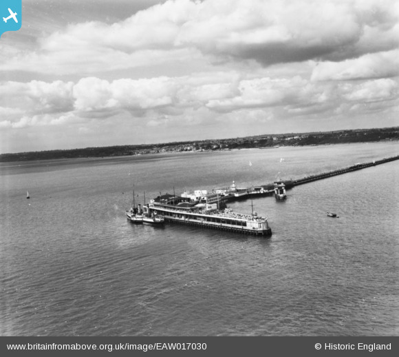
EAW017030 ENGLAND (1948). The Southend Pier Prince George Extension, Southend-on-Sea, from the south, 1948. This image has been produced from a print.
© Copyright OpenStreetMap contributors and licensed by the OpenStreetMap Foundation. 2026. Cartography is licensed as CC BY-SA.
Nearby Images (36)
EAW017030

EAW026905

EPW040976

EPW062735

EPW062736

EAW017028

EAW002215

EPW062734

EAW017027

EAW038547

EAW026902

EAW038548

EAW026938

EAW026940

EAW026900

EAW026903

EPW040977

EPW024882

EPW062737

EAW026904

EAW002216

EAW017026

EPW036622

EAW026937

EPW024880

EAW017029

EPW000446

EAW026939

EAW042706

EAW054228

EAW026901

EAW042705

EAW002214

EPW036623

EPW000561

EPW000445

Details
| Title | [EAW017030] The Southend Pier Prince George Extension, Southend-on-Sea, from the south, 1948. This image has been produced from a print. |
| Reference | EAW017030 |
| Date | 6-July-1948 |
| Link | |
| Place name | SOUTHEND-ON-SEA |
| Parish | |
| District | |
| Country | ENGLAND |
| Easting / Northing | 589030, 182984 |
| Longitude / Latitude | 0.72457998348155, 51.513625775015 |
| National Grid Reference | TQ890830 |
Pins
Be the first to add a comment to this image!