
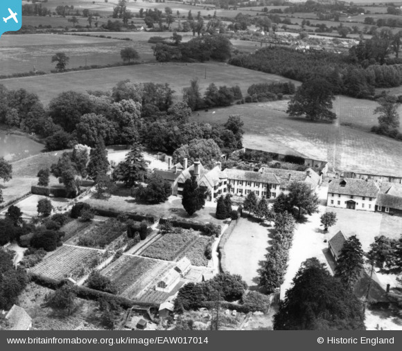
EAW017014 ENGLAND (1948). Manor House, Little Easton, 1948. This image has been produced from a print.
© Copyright OpenStreetMap contributors and licensed by the OpenStreetMap Foundation. 2026. Cartography is licensed as CC BY-SA.
Nearby Images (5)
EAW017014

EAW017015

EAW017012

EAW017013

EAW017011

Details
| Title | [EAW017014] Manor House, Little Easton, 1948. This image has been produced from a print. |
| Reference | EAW017014 |
| Date | 6-July-1948 |
| Link | |
| Place name | LITTLE EASTON |
| Parish | LITTLE EASTON |
| District | |
| Country | ENGLAND |
| Easting / Northing | 560433, 223611 |
| Longitude / Latitude | 0.33148920260366, 51.887497696115 |
| National Grid Reference | TL604236 |
Pins

Matt Aldred edob.mattaldred.com |
Saturday 29th of January 2022 06:07:37 PM |