
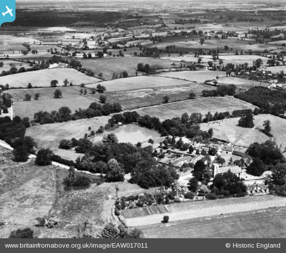
EAW017011 ENGLAND (1948). Manor House, Great Pond and the surrounding countryside, Little Easton, from the south, 1948. This image has been produced from a print.
© Copyright OpenStreetMap contributors and licensed by the OpenStreetMap Foundation. 2026. Cartography is licensed as CC BY-SA.
Nearby Images (5)
EAW017011

EAW017012

EAW017013

EAW017015

EAW017014

Details
| Title | [EAW017011] Manor House, Great Pond and the surrounding countryside, Little Easton, from the south, 1948. This image has been produced from a print. |
| Reference | EAW017011 |
| Date | 6-July-1948 |
| Link | |
| Place name | LITTLE EASTON |
| Parish | LITTLE EASTON |
| District | |
| Country | ENGLAND |
| Easting / Northing | 560350, 223461 |
| Longitude / Latitude | 0.33021435482877, 51.886173907683 |
| National Grid Reference | TL604235 |
Pins

Matt Aldred edob.mattaldred.com |
Saturday 21st of September 2019 06:39:11 PM |