
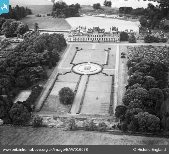
EAW016678 ENGLAND (1948). Castle Howard House and Grounds, Castle Howard, 1948
© Copyright OpenStreetMap contributors and licensed by the OpenStreetMap Foundation. 2026. Cartography is licensed as CC BY-SA.
Nearby Images (3)
EAW016678

EAW016681

EAW016682

Details
| Title | [EAW016678] Castle Howard House and Grounds, Castle Howard, 1948 |
| Reference | EAW016678 |
| Date | 23-June-1948 |
| Link | |
| Place name | CASTLE HOWARD |
| Parish | HENDERSKELFE |
| District | |
| Country | ENGLAND |
| Easting / Northing | 471647, 469902 |
| Longitude / Latitude | -0.90370275731353, 54.119808355903 |
| National Grid Reference | SE716699 |
Pins
Be the first to add a comment to this image!