
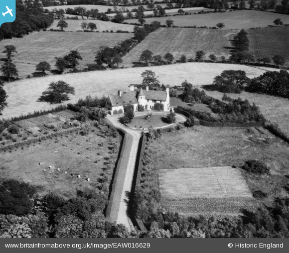
EAW016629 ENGLAND (1948). Lorraine (Hyver Manor), Hyver Hall, 1948
© Copyright OpenStreetMap contributors and licensed by the OpenStreetMap Foundation. 2026. Cartography is licensed as CC BY-SA.
Nearby Images (4)
EAW016629
, Hyver Hall, 1948")
EAW016631
 and surrounding countryside, Hyver Hall, 1948")
EAW016630
 and surrounding countryside, Hyver Hall, 1948")
EAW016628
 and surrounding countryside, Hyver Hall, 1948")
Details
| Title | [EAW016629] Lorraine (Hyver Manor), Hyver Hall, 1948 |
| Reference | EAW016629 |
| Date | 17-June-1948 |
| Link | |
| Place name | HYVER HALL |
| Parish | |
| District | |
| Country | ENGLAND |
| Easting / Northing | 521132, 194780 |
| Longitude / Latitude | -0.24936923800128, 51.638296423834 |
| National Grid Reference | TQ211948 |
Pins

Matt Aldred edob.mattaldred.com |
Thursday 7th of March 2024 01:31:35 PM |
User Comment Contributions
Please see comments on previous picture and under Factual Summary. |

JohnWiles42 |
Tuesday 4th of February 2014 07:52:20 PM |