
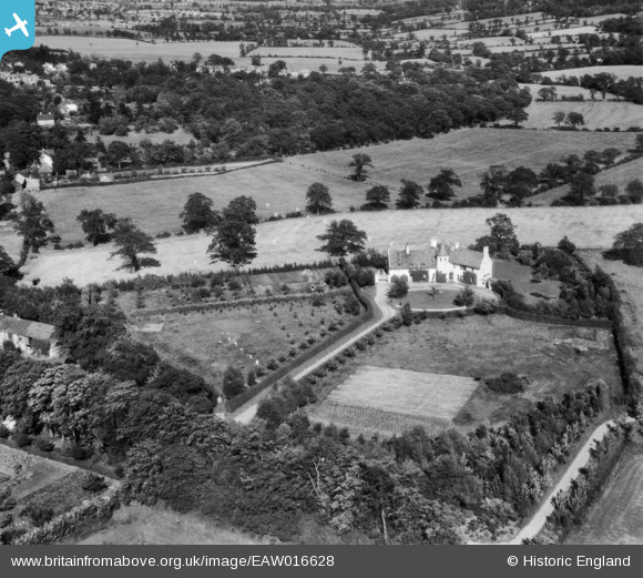
EAW016628 ENGLAND (1948). Lorraine (Hyver Manor) and surrounding countryside, Hyver Hall, 1948
© Copyright OpenStreetMap contributors and licensed by the OpenStreetMap Foundation. 2026. Cartography is licensed as CC BY-SA.
Nearby Images (4)
EAW016628
 and surrounding countryside, Hyver Hall, 1948")
EAW016630
 and surrounding countryside, Hyver Hall, 1948")
EAW016631
 and surrounding countryside, Hyver Hall, 1948")
EAW016629
, Hyver Hall, 1948")
Details
| Title | [EAW016628] Lorraine (Hyver Manor) and surrounding countryside, Hyver Hall, 1948 |
| Reference | EAW016628 |
| Date | 17-June-1948 |
| Link | |
| Place name | HYVER HALL |
| Parish | |
| District | |
| Country | ENGLAND |
| Easting / Northing | 521158, 194813 |
| Longitude / Latitude | -0.24898224185915, 51.638587429777 |
| National Grid Reference | TQ212948 |
Pins

Matt Aldred edob.mattaldred.com |
Thursday 7th of March 2024 01:31:29 PM |
User Comment Contributions
John & Dorothy (Doffy) Holness were my Grandparents! I have photos of my brothers & I on the front lawn, by the well. Such a beautiful house. |

LizM |
Sunday 3rd of May 2015 09:21:20 PM |
Lorraine is on Hyver Hill not Hyver Hall. See full details under Factual summary. |
JohnWiles42 |
Wednesday 5th of February 2014 10:08:25 AM |
It's fascinating to learn so much of the history of this house. Thank you. |
Lynda Tubbs |
Wednesday 5th of February 2014 10:08:25 AM |