
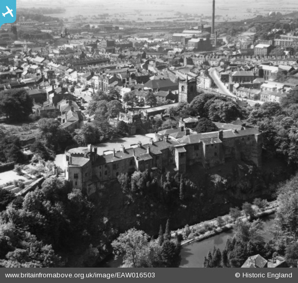
EAW016503 ENGLAND (1948). Skipton Castle and the town centre, Skipton, 1948. This image has been produced from a print.
© Copyright OpenStreetMap contributors and licensed by the OpenStreetMap Foundation. 2026. Cartography is licensed as CC BY-SA.
Nearby Images (14)
EAW016503

EAW004589

EAW004591

EAW013872

EAW016504

EAW013871

EAW004590

EAW016500
 and the town, Skipton, 1948. This image has been produced from a damaged negative.")
EAW016502
, Skipton, 1948. This image has been produced from a damaged negative.")
EAW004588

EAW016499

EAW013874

EAW016501
, Skipton, 1948. This image has been produced from a damaged negative.")
EAW013873

Details
| Title | [EAW016503] Skipton Castle and the town centre, Skipton, 1948. This image has been produced from a print. |
| Reference | EAW016503 |
| Date | 11-June-1948 |
| Link | |
| Place name | SKIPTON |
| Parish | SKIPTON |
| District | |
| Country | ENGLAND |
| Easting / Northing | 399126, 451987 |
| Longitude / Latitude | -2.0133231464444, 53.963768369618 |
| National Grid Reference | SD991520 |
