
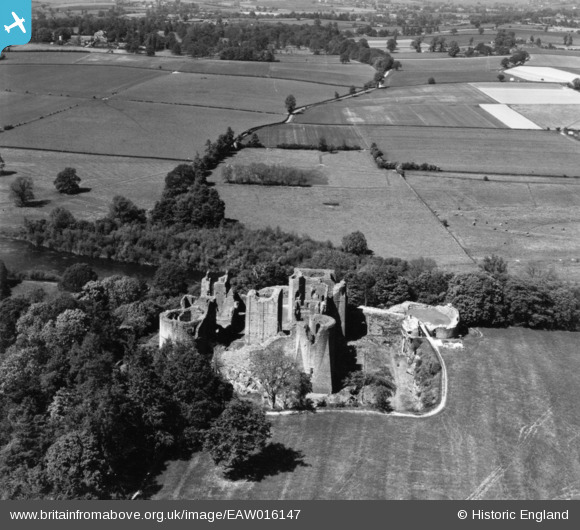
EAW016147 ENGLAND (1948). Goodrich Castle, Goodrich, 1948. This image has been produced from a print.
© Copyright OpenStreetMap contributors and licensed by the OpenStreetMap Foundation. 2026. Cartography is licensed as CC BY-SA.
Nearby Images (13)
EAW016147

EAW006652

EAW016144

EAW006653

EAW018450

EPW039983

EAW006651

EAW006654

EAW006655

EAW018449

EAW016145

EAW016146

EAW016148
 and Tanners Close, Goodrich, 1948. This image has been produced from a damaged negative.")
Details
| Title | [EAW016147] Goodrich Castle, Goodrich, 1948. This image has been produced from a print. |
| Reference | EAW016147 |
| Date | 21-May-1948 |
| Link | |
| Place name | GOODRICH |
| Parish | GOODRICH |
| District | |
| Country | ENGLAND |
| Easting / Northing | 357725, 220169 |
| Longitude / Latitude | -2.6141942349067, 51.878043841991 |
| National Grid Reference | SO577202 |
Pins
Be the first to add a comment to this image!