
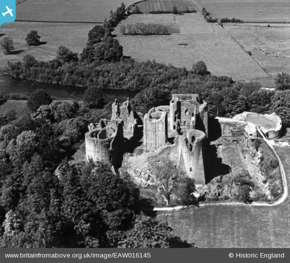
EAW016145 ENGLAND (1948). Goodrich Castle, Goodrich, 1948. This image has been produced from a print.
© Copyright OpenStreetMap contributors and licensed by the OpenStreetMap Foundation. 2026. Cartography is licensed as CC BY-SA.
Nearby Images (13)
EAW016145

EAW006655

EAW006654

EAW006653

EAW018449

EAW006651

EAW018450

EPW039983

EAW006652

EAW016144

EAW016148
 and Tanners Close, Goodrich, 1948. This image has been produced from a damaged negative.")
EAW016146

EAW016147

Details
| Title | [EAW016145] Goodrich Castle, Goodrich, 1948. This image has been produced from a print. |
| Reference | EAW016145 |
| Date | 21-May-1948 |
| Link | |
| Place name | GOODRICH |
| Parish | GOODRICH |
| District | |
| Country | ENGLAND |
| Easting / Northing | 357698, 219966 |
| Longitude / Latitude | -2.6145615953453, 51.876216537568 |
| National Grid Reference | SO577200 |
Pins
Be the first to add a comment to this image!