
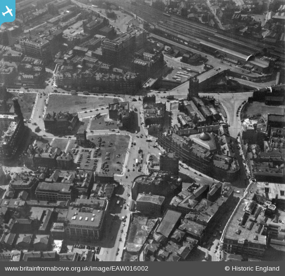
EAW016002 ENGLAND (1948). Victoria Street and environs, Manchester, 1948. This image has been produced from a print.
© Copyright OpenStreetMap contributors and licensed by the OpenStreetMap Foundation. 2026. Cartography is licensed as CC BY-SA.
Nearby Images (9)
EAW016002

EAW016006

EPW019091

EPW057316
 and environs, Manchester, 1938")
EPW057692
 and environs, Salford, 1938")
EPW060538

EPW057314
 and environs, Salford, 1938")
EPW057693

EAW016004

Details
| Title | [EAW016002] Victoria Street and environs, Manchester, 1948. This image has been produced from a print. |
| Reference | EAW016002 |
| Date | 19-May-1948 |
| Link | |
| Place name | MANCHESTER |
| Parish | |
| District | |
| Country | ENGLAND |
| Easting / Northing | 383900, 398663 |
| Longitude / Latitude | -2.2426499096995, 53.484186735715 |
| National Grid Reference | SJ839987 |
Pins

sps1955 |
Saturday 18th of January 2025 06:12:54 PM | |
|
I Sharratt |
Monday 22nd of June 2020 01:43:07 AM | |

totoro |
Sunday 10th of January 2016 10:05:48 PM |