
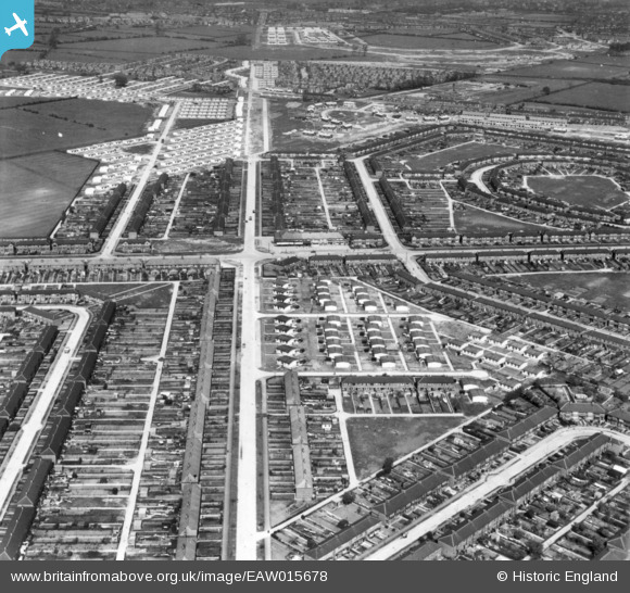
EAW015678 ENGLAND (1948). Hotham Road and environs, Kingston upon Hull, 1948. This image has been produced from a print.
© Copyright OpenStreetMap contributors and licensed by the OpenStreetMap Foundation. 2026. Cartography is licensed as CC BY-SA.
Nearby Images (3)
EAW015678

EAW015677

EAW015676

Details
| Title | [EAW015678] Hotham Road and environs, Kingston upon Hull, 1948. This image has been produced from a print. |
| Reference | EAW015678 |
| Date | 18-May-1948 |
| Link | |
| Place name | KINGSTON UPON HULL |
| Parish | |
| District | |
| Country | ENGLAND |
| Easting / Northing | 504944, 430070 |
| Longitude / Latitude | -0.40808371496135, 53.756188601571 |
| National Grid Reference | TA049301 |
Pins
Be the first to add a comment to this image!