
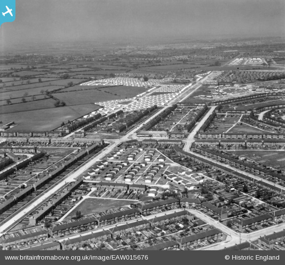
EAW015676 ENGLAND (1948). Pre-fabricated housing off Hotham Road and environs, Kingston upon Hull, from the south, 1948. This image has been produced from a print.
© Copyright OpenStreetMap contributors and licensed by the OpenStreetMap Foundation. 2026. Cartography is licensed as CC BY-SA.
Nearby Images (3)
EAW015676

EAW015677

EAW015678

Details
| Title | [EAW015676] Pre-fabricated housing off Hotham Road and environs, Kingston upon Hull, from the south, 1948. This image has been produced from a print. |
| Reference | EAW015676 |
| Date | 18-May-1948 |
| Link | |
| Place name | KINGSTON UPON HULL |
| Parish | |
| District | |
| Country | ENGLAND |
| Easting / Northing | 504879, 429936 |
| Longitude / Latitude | -0.4091148053306, 53.754997617114 |
| National Grid Reference | TA049299 |
Pins

DP |
Thursday 17th of March 2016 07:18:11 AM | |
|
DP |
Thursday 17th of March 2016 07:17:33 AM | |
|
DP |
Thursday 17th of March 2016 07:16:34 AM | |
|
DP |
Wednesday 16th of March 2016 11:28:15 AM |