
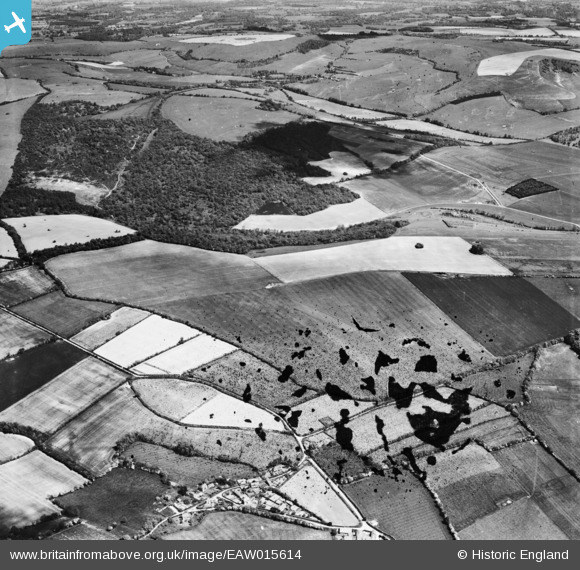
EAW015614 ENGLAND (1948). Combe Wood and Linkenholt Hanging, Linkenholt, 1948. This image has been produced from a damaged negative.
© Copyright OpenStreetMap contributors and licensed by the OpenStreetMap Foundation. 2026. Cartography is licensed as CC BY-SA.
Nearby Images (2)
EAW015614

EAW015615

Details
| Title | [EAW015614] Combe Wood and Linkenholt Hanging, Linkenholt, 1948. This image has been produced from a damaged negative. |
| Reference | EAW015614 |
| Date | 14-May-1948 |
| Link | |
| Place name | LINKENHOLT |
| Parish | LINKENHOLT |
| District | |
| Country | ENGLAND |
| Easting / Northing | 435513, 158623 |
| Longitude / Latitude | -1.4902773432463, 51.32509455913 |
| National Grid Reference | SU355586 |
Pins
Be the first to add a comment to this image!