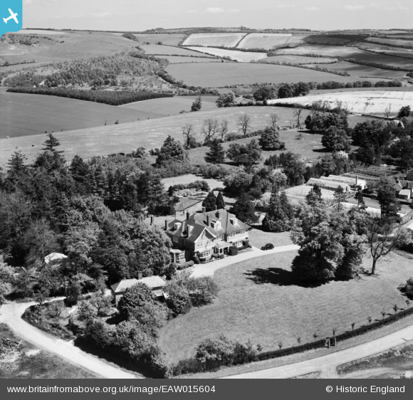
EAW015604 ENGLAND (1948). Manor House, Linkenholt, from the south-west, 1948
© Copyright OpenStreetMap contributors and licensed by the OpenStreetMap Foundation. 2025. Cartography is licensed as CC BY-SA.
Details
| Title | [EAW015604] Manor House, Linkenholt, from the south-west, 1948 |
| Reference | EAW015604 |
| Date | 14-May-1948 |
| Link | |
| Place name | LINKENHOLT |
| Parish | LINKENHOLT |
| District | |
| Country | ENGLAND |
| Easting / Northing | 436156, 158106 |
| Longitude / Latitude | -1.4811011484285, 51.32040495912 |
| National Grid Reference | SU362581 |
Pins

totoro |
Friday 7th of November 2014 08:52:05 PM |


![[EAW015604] Manor House, Linkenholt, from the south-west, 1948](http://britainfromabove.org.uk/sites/all/libraries/aerofilms-images/public/100x100/EAW/015/EAW015604.jpg)
![[EAW015603] Manor House, Linkenholt, from the south-east, 1948](http://britainfromabove.org.uk/sites/all/libraries/aerofilms-images/public/100x100/EAW/015/EAW015603.jpg)
![[EAW015596] The Manor House, Linkenholt, from the south-east, 1948](http://britainfromabove.org.uk/sites/all/libraries/aerofilms-images/public/100x100/EAW/015/EAW015596.jpg)
![[EAW015595] The Manor House, Linkenholt, 1948](http://britainfromabove.org.uk/sites/all/libraries/aerofilms-images/public/100x100/EAW/015/EAW015595.jpg)