
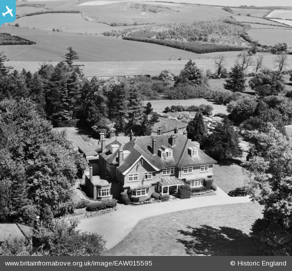
EAW015595 ENGLAND (1948). The Manor House, Linkenholt, 1948
© Copyright OpenStreetMap contributors and licensed by the OpenStreetMap Foundation. 2026. Cartography is licensed as CC BY-SA.
Nearby Images (4)
EAW015595

EAW015596

EAW015603

EAW015604

Details
| Title | [EAW015595] The Manor House, Linkenholt, 1948 |
| Reference | EAW015595 |
| Date | 14-May-1948 |
| Link | |
| Place name | LINKENHOLT |
| Parish | LINKENHOLT |
| District | |
| Country | ENGLAND |
| Easting / Northing | 436214, 158160 |
| Longitude / Latitude | -1.480263300577, 51.320886858917 |
| National Grid Reference | SU362582 |
Pins

totoro |
Friday 7th of November 2014 08:50:03 PM |