
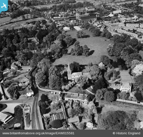
EAW015581 ENGLAND (1948). St Stephen's Church and the surrounding area, St Albans, 1948
© Copyright OpenStreetMap contributors and licensed by the OpenStreetMap Foundation. 2026. Cartography is licensed as CC BY-SA.
Nearby Images (7)
EAW015581

EAW015582

EAW015593

EAW022725

EAW022724

EAW022723

EAW022726

Details
| Title | [EAW015581] St Stephen's Church and the surrounding area, St Albans, 1948 |
| Reference | EAW015581 |
| Date | 13-May-1948 |
| Link | |
| Place name | ST ALBANS |
| Parish | |
| District | |
| Country | ENGLAND |
| Easting / Northing | 514174, 206112 |
| Longitude / Latitude | -0.34617291056944, 51.741609576627 |
| National Grid Reference | TL142061 |
Pins

Sandyn |
Saturday 21st of August 2021 05:19:39 PM | |
|
John W |
Tuesday 2nd of August 2016 05:31:20 PM | |
|
John W |
Tuesday 2nd of August 2016 05:30:07 PM | |
|
John W |
Tuesday 2nd of August 2016 05:29:36 PM | |
|
John W |
Tuesday 2nd of August 2016 05:28:35 PM |