
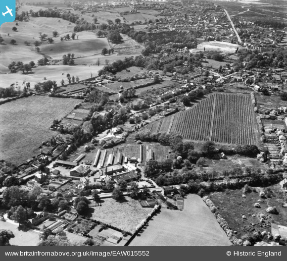
EAW015552 ENGLAND (1948). The Hale Laundry Ltd and its drying grounds, Hale, 1948. This image has been produced from a print.
© Copyright OpenStreetMap contributors and licensed by the OpenStreetMap Foundation. 2026. Cartography is licensed as CC BY-SA.
Nearby Images (10)
EAW015552

EAW015555

EAW015554

EAW015537

EAW015551

EAW015549

EAW015553

EAW015547

EAW015550

EAW015548

Details
| Title | [EAW015552] The Hale Laundry Ltd and its drying grounds, Hale, 1948. This image has been produced from a print. |
| Reference | EAW015552 |
| Date | 14-May-1948 |
| Link | |
| Place name | HALE |
| Parish | FARNHAM |
| District | |
| Country | ENGLAND |
| Easting / Northing | 484732, 148622 |
| Longitude / Latitude | -0.78632367762818, 51.229973506434 |
| National Grid Reference | SU847486 |
Pins

Matt Aldred edob.mattaldred.com |
Thursday 11th of March 2021 12:55:01 PM | |
|
Matt Aldred edob.mattaldred.com |
Thursday 11th of March 2021 12:54:49 PM | |
|
Matt Aldred edob.mattaldred.com |
Thursday 11th of March 2021 12:54:27 PM | |

jrussill |
Wednesday 13th of May 2015 03:17:08 PM | |
|
jrussill |
Wednesday 13th of May 2015 03:16:50 PM | |
|
jrussill |
Wednesday 13th of May 2015 03:16:28 PM |
User Comment Contributions

WW2 Pillboxes |
jrussill |
Wednesday 13th of May 2015 03:18:07 PM |