
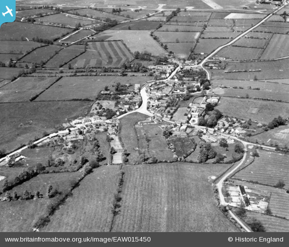
EAW015450 ENGLAND (1948). The village, Walton, 1948. This image has been produced from a print.
© Copyright OpenStreetMap contributors and licensed by the OpenStreetMap Foundation. 2026. Cartography is licensed as CC BY-SA.
Nearby Images (6)
EAW015450

EAW015446

EAW015448

EAW015451

EAW015447

EAW015449

Details
| Title | [EAW015450] The village, Walton, 1948. This image has been produced from a print. |
| Reference | EAW015450 |
| Date | 13-May-1948 |
| Link | |
| Place name | WALTON |
| Parish | KIMCOTE AND WALTON |
| District | |
| Country | ENGLAND |
| Easting / Northing | 459535, 286978 |
| Longitude / Latitude | -1.1233392535812, 52.477109613452 |
| National Grid Reference | SP595870 |
Pins

redmist |
Saturday 1st of August 2020 10:51:03 PM | |
|
redmist |
Saturday 1st of August 2020 10:50:06 PM | |
|
redmist |
Saturday 1st of August 2020 10:48:44 PM | |
|
redmist |
Saturday 1st of August 2020 10:48:12 PM |