
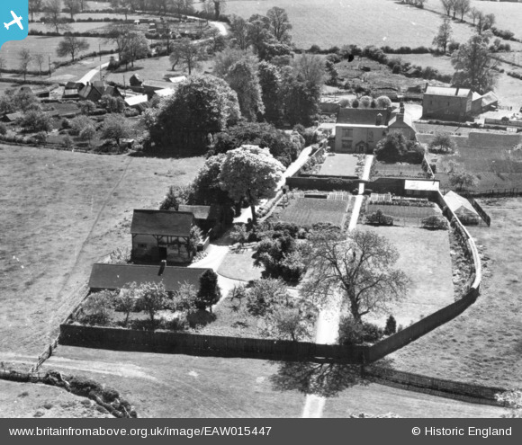
EAW015447 ENGLAND (1948). Walton Hall, Walton, 1948. This image has been produced from a print.
© Copyright OpenStreetMap contributors and licensed by the OpenStreetMap Foundation. 2026. Cartography is licensed as CC BY-SA.
Nearby Images (6)
EAW015447

EAW015449

EAW015448

EAW015446

EAW015451

EAW015450

Details
| Title | [EAW015447] Walton Hall, Walton, 1948. This image has been produced from a print. |
| Reference | EAW015447 |
| Date | 13-May-1948 |
| Link | |
| Place name | WALTON |
| Parish | KIMCOTE AND WALTON |
| District | |
| Country | ENGLAND |
| Easting / Northing | 459672, 287027 |
| Longitude / Latitude | -1.1213133922851, 52.477535156959 |
| National Grid Reference | SP597870 |
Pins
Be the first to add a comment to this image!