
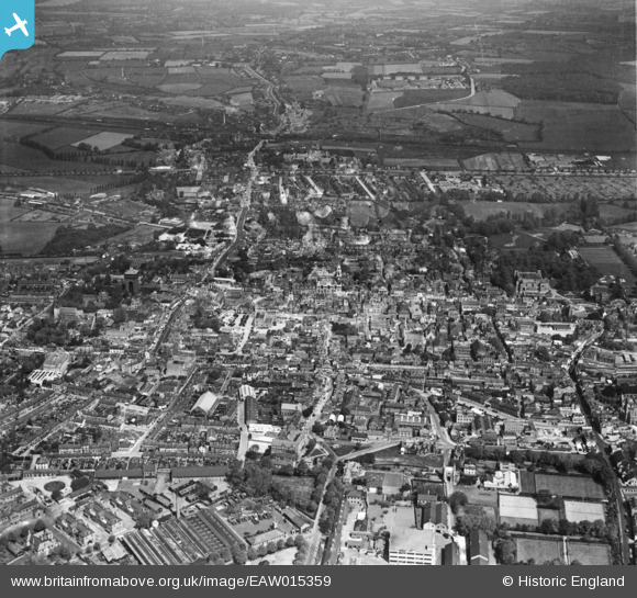
EAW015359 ENGLAND (1948). The town, Colchester, 1948. This image has been produced from a damaged negative.
© Copyright OpenStreetMap contributors and licensed by the OpenStreetMap Foundation. 2026. Cartography is licensed as CC BY-SA.
Nearby Images (35)
EAW015359

EPW018552

EPW058741

EAW037493

EPW018559

EAW037497

EAW037258

EAW024677

EPW058742

EAW037257

EAW029731

EPW018555

EAW037494

EAW037492

EAW024675

EAW029732

EPW018553

EAW029733

EAW029730

EAW037495

EPW018550

EAW037255

EAW056122

EAW014002

EPW001860

EPW058740

EAW029725

EAW014008

EAW037491

EAW037254

EAW037499

EAW037256

EAW029724

EAW037498

EAW029728

Details
| Title | [EAW015359] The town, Colchester, 1948. This image has been produced from a damaged negative. |
| Reference | EAW015359 |
| Date | 7-May-1948 |
| Link | |
| Place name | COLCHESTER |
| Parish | |
| District | |
| Country | ENGLAND |
| Easting / Northing | 599573, 225220 |
| Longitude / Latitude | 0.90051152747582, 51.889311666767 |
| National Grid Reference | TL996252 |
Pins

Stephen Mirrington |
Tuesday 30th of September 2025 08:14:04 PM |