
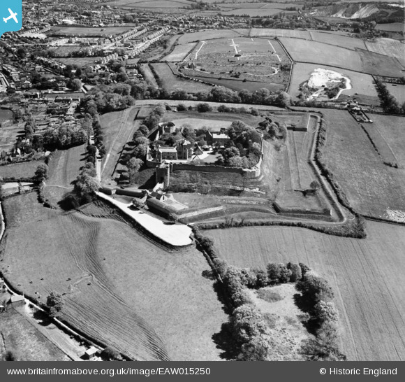
EAW015250 ENGLAND (1948). Carisbrooke Castle, Carisbrooke, 1948
© Copyright OpenStreetMap contributors and licensed by the OpenStreetMap Foundation. 2025. Cartography is licensed as CC BY-SA.
Nearby Images (9)
EAW015250

EPW023019

EAW015251

EPW023028

EAW015252

EPW032331

EAW015253

EPW023027

EPW023018

Details
| Title | [EAW015250] Carisbrooke Castle, Carisbrooke, 1948 |
| Reference | EAW015250 |
| Date | 6-May-1948 |
| Link | |
| Place name | CARISBROOKE |
| Parish | NEWPORT |
| District | |
| Country | ENGLAND |
| Easting / Northing | 448533, 87712 |
| Longitude / Latitude | -1.3128981798967, 50.686457162328 |
| National Grid Reference | SZ485877 |
Pins
Be the first to add a comment to this image!
User Comment Contributions
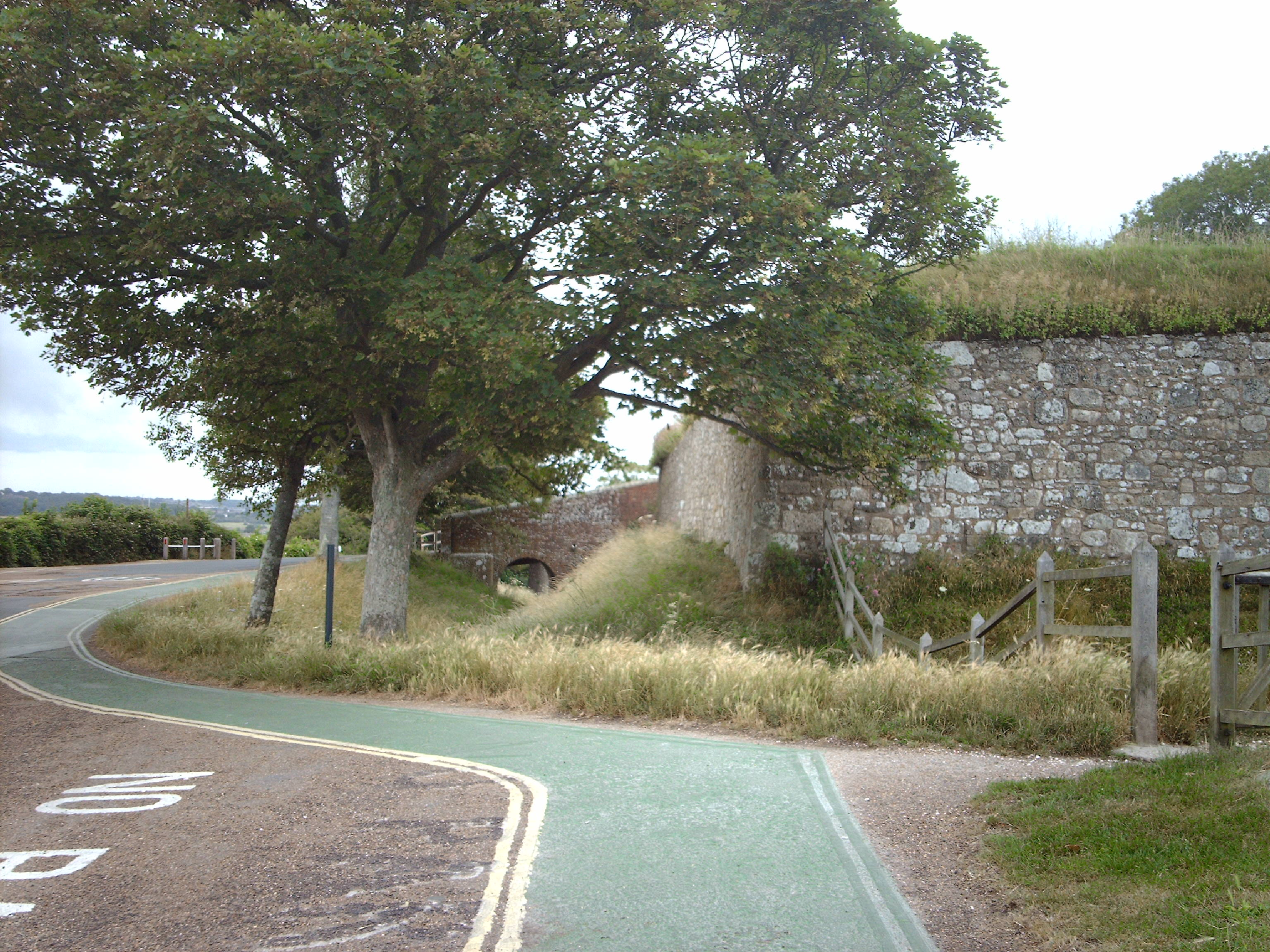
Carisbrooke Castle, 06/07/2006 |

Class31 |
Monday 12th of January 2015 02:35:12 PM |