
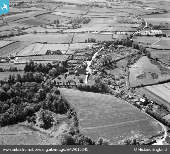
EAW015245 ENGLAND (1948). All Saints' Church and the village, Newchurch, 1948
© Copyright OpenStreetMap contributors and licensed by the OpenStreetMap Foundation. 2026. Cartography is licensed as CC BY-SA.
Nearby Images (3)
EAW015245

EAW015244

EAW015246

Details
| Title | [EAW015245] All Saints' Church and the village, Newchurch, 1948 |
| Reference | EAW015245 |
| Date | 6-May-1948 |
| Link | |
| Place name | NEWCHURCH |
| Parish | NEWCHURCH |
| District | |
| Country | ENGLAND |
| Easting / Northing | 456171, 85560 |
| Longitude / Latitude | -1.2051011576736, 50.666416930601 |
| National Grid Reference | SZ562856 |
Pins

Alan |
Wednesday 21st of October 2020 10:43:12 AM |