
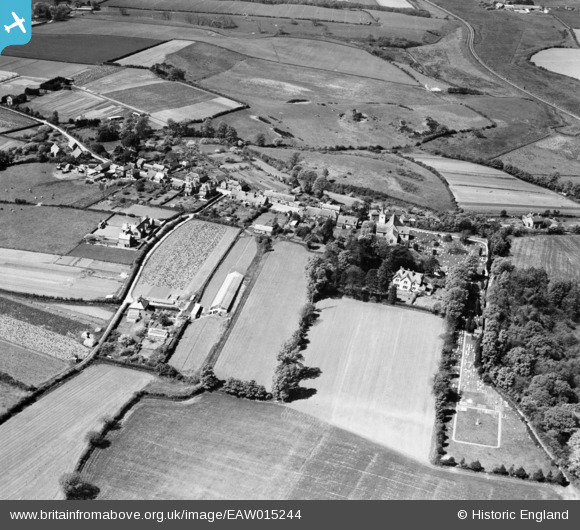
EAW015244 ENGLAND (1948). The village, Newchurch, 1948
© Copyright OpenStreetMap contributors and licensed by the OpenStreetMap Foundation. 2026. Cartography is licensed as CC BY-SA.
Nearby Images (3)
EAW015244

EAW015246

EAW015245

Details
| Title | [EAW015244] The village, Newchurch, 1948 |
| Reference | EAW015244 |
| Date | 6-May-1948 |
| Link | |
| Place name | NEWCHURCH |
| Parish | NEWCHURCH |
| District | |
| Country | ENGLAND |
| Easting / Northing | 456223, 85484 |
| Longitude / Latitude | -1.20437691104, 50.665728447633 |
| National Grid Reference | SZ562855 |
Pins

Alan |
Friday 10th of July 2020 10:43:39 AM |