
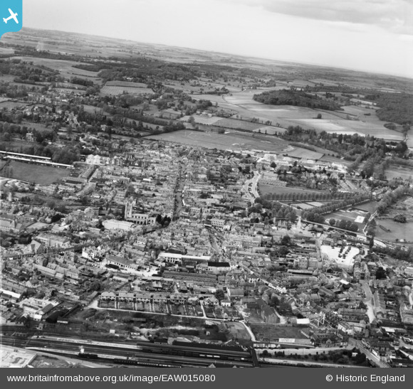
EAW015080 ENGLAND (1948). The town, Newbury, from the south, 1948
© Copyright OpenStreetMap contributors and licensed by the OpenStreetMap Foundation. 2026. Cartography is licensed as CC BY-SA.
Nearby Images (14)
EAW015080

EPW022629

EPW022630

EPW022626

EPW011079

EPW054556

EAW015079

EPW054558

EPW054557

EPW054552

EPW054554

EPW054555

EPW054553

EPW011076

Details
| Title | [EAW015080] The town, Newbury, from the south, 1948 |
| Reference | EAW015080 |
| Date | 29-April-1948 |
| Link | |
| Place name | NEWBURY |
| Parish | NEWBURY |
| District | |
| Country | ENGLAND |
| Easting / Northing | 447182, 166904 |
| Longitude / Latitude | -1.3217026500863, 51.39870951673 |
| National Grid Reference | SU472669 |
Pins

Matt Aldred edob.mattaldred.com |
Sunday 29th of November 2020 08:26:21 PM | |
|
Matt Aldred edob.mattaldred.com |
Sunday 29th of November 2020 08:23:54 PM | |

RodL |
Thursday 22nd of October 2015 10:45:18 PM | |
|
Julierosalie |
Tuesday 22nd of April 2014 11:55:21 PM | |
|
Julierosalie |
Tuesday 22nd of April 2014 11:50:29 PM | |
|
cptpies |
Tuesday 17th of December 2013 12:42:02 PM |
User Comment Contributions

Type 22 pillbox, Newbury. |
cptpies |
Thursday 19th of December 2013 02:20:25 PM |