
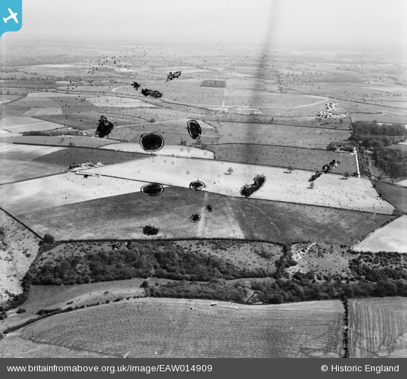
EAW014909 ENGLAND (1948). Akeman Street (Roman Road) at Wisdom's Copse and surrounding countryside, Asthall Leigh, from the west, 1948. This image has been produced from a damaged negative.
© Copyright OpenStreetMap contributors and licensed by the OpenStreetMap Foundation. 2026. Cartography is licensed as CC BY-SA.
Nearby Images (2)
EAW014909
 at Wisdom's Copse and surrounding countryside, Asthall Leigh, from the west, 1948. This image has been produced from a damaged negative.")
EAW014908

Details
| Title | [EAW014909] Akeman Street (Roman Road) at Wisdom's Copse and surrounding countryside, Asthall Leigh, from the west, 1948. This image has been produced from a damaged negative. |
| Reference | EAW014909 |
| Date | 26-April-1948 |
| Link | |
| Place name | ASTHALL LEIGH |
| Parish | ASTHAL |
| District | |
| Country | ENGLAND |
| Easting / Northing | 431332, 212741 |
| Longitude / Latitude | -1.5454584901357, 51.811975954291 |
| National Grid Reference | SP313127 |
Pins

Jed |
Wednesday 21st of May 2014 11:06:32 PM |