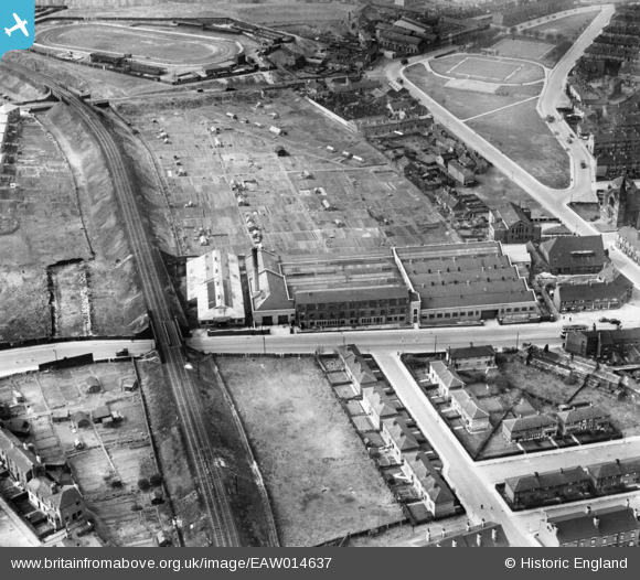
EAW014637 ENGLAND (1948). The Cooperative Wholesale Society Brush Works on Belle Isle Road and environs, Hunslet Carr, 1948
© Copyright OpenStreetMap contributors and licensed by the OpenStreetMap Foundation. 2026. Cartography is licensed as CC BY-SA.
Nearby Images (6)
Details
| Title | [EAW014637] The Cooperative Wholesale Society Brush Works on Belle Isle Road and environs, Hunslet Carr, 1948 |
| Reference | EAW014637 |
| Date | 21-April-1948 |
| Link | |
| Place name | HUNSLET CARR |
| Parish | |
| District | |
| Country | ENGLAND |
| Easting / Northing | 430959, 430632 |
| Longitude / Latitude | -1.5302292979479, 53.770890674302 |
| National Grid Reference | SE310306 |
Pins

gerry-r |
Monday 16th of June 2014 11:27:25 PM | |

Cabby |
Wednesday 22nd of January 2014 10:30:32 PM | |

Cabby |
Wednesday 22nd of January 2014 10:29:22 PM | |

Cabby |
Wednesday 22nd of January 2014 10:28:34 PM | |

Cabby |
Wednesday 22nd of January 2014 10:27:02 PM | |

Cabby |
Wednesday 22nd of January 2014 10:25:10 PM | |

Cabby |
Wednesday 22nd of January 2014 10:23:27 PM |


![[EAW014637] The Cooperative Wholesale Society Brush Works on Belle Isle Road and environs, Hunslet Carr, 1948](http://britainfromabove.org.uk/sites/all/libraries/aerofilms-images/public/100x100/EAW/014/EAW014637.jpg)
![[EAW014638] The Cooperative Wholesale Society Brush Works on Belle Isle Road and environs, Hunslet Carr, 1948](http://britainfromabove.org.uk/sites/all/libraries/aerofilms-images/public/100x100/EAW/014/EAW014638.jpg)
![[EAW014635] The Cooperative Wholesale Society Brush Works on Belle Isle Road and environs, Hunslet Carr, 1948. This image has been produced from a print.](http://britainfromabove.org.uk/sites/all/libraries/aerofilms-images/public/100x100/EAW/014/EAW014635.jpg)
![[EAW014640] The Cooperative Wholesale Society Brush Works on Belle Isle Road and environs, Hunslet Carr, 1948](http://britainfromabove.org.uk/sites/all/libraries/aerofilms-images/public/100x100/EAW/014/EAW014640.jpg)
![[EAW014639] The Cooperative Wholesale Society Brush Works on Belle Isle Road and adjacent allotments, Hunslet Carr, 1948](http://britainfromabove.org.uk/sites/all/libraries/aerofilms-images/public/100x100/EAW/014/EAW014639.jpg)
![[EAW014636] The Cooperative Wholesale Society Brush Works on Belle Isle Road and environs, Hunslet Carr, 1948. This image was marked by Aerofilms Ltd for photo editing.](http://britainfromabove.org.uk/sites/all/libraries/aerofilms-images/public/100x100/EAW/014/EAW014636.jpg)