
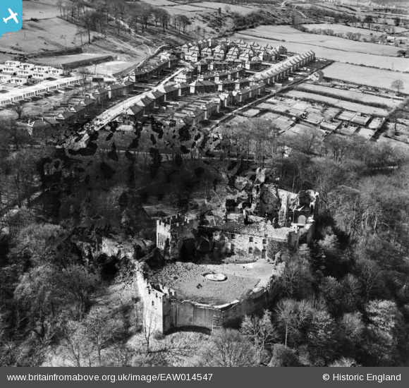
EAW014547 ENGLAND (1948). Prudhoe Castle and housing surrounding Castle Road, Prudhoe, 1948. This image has been produced from a damaged negative.
© Copyright OpenStreetMap contributors and licensed by the OpenStreetMap Foundation. 2026. Cartography is licensed as CC BY-SA.
Nearby Images (3)
EAW014547

EAW014545

EAW014546
 Chemical Works, Prudhoe, 1948. This image has been produced from a damaged negative.")
Details
| Title | [EAW014547] Prudhoe Castle and housing surrounding Castle Road, Prudhoe, 1948. This image has been produced from a damaged negative. |
| Reference | EAW014547 |
| Date | 15-April-1948 |
| Link | |
| Place name | PRUDHOE |
| Parish | PRUDHOE |
| District | |
| Country | ENGLAND |
| Easting / Northing | 409173, 563337 |
| Longitude / Latitude | -1.8567139297591, 54.964500328342 |
| National Grid Reference | NZ092633 |
Pins
Be the first to add a comment to this image!